|
Change Detection Results |
 |
Using the measuring tool in ArcGIS you can measure the linear retreat in the terminus which, at the location shown in the figure, is of the order of about 400 m between 2000 and 2005.
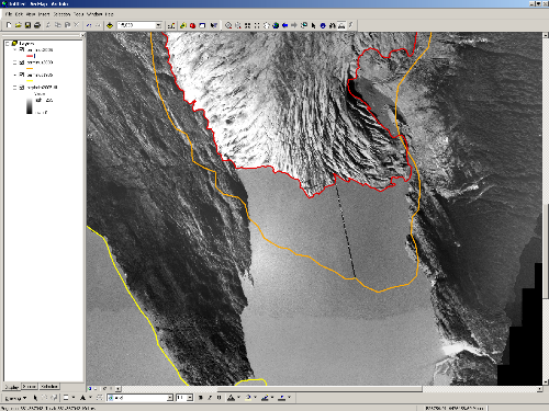 |
Using image data alone measured linear glacier retreat at this location is about 400 m.
Data processed by Rudi Gens |
A comparison of the 2000 and August 2005 terminus positions indicates that a significant amount of the ice loss occurred along the lacustrine glacier terminus, in particular along its eastern half. This is consistent with field-based observations of the calving terminus over the five-year interval between the images.
Warren et al (2001) noted that lacustrine glacier termini typically undergo a period of downwasting and narrowing prior to the onset of rapid terminus retreat. The behavior of Mendenhall Glacier agrees qualitatively with observations of other lake-calving glaciers.
|
Change in Lake Extent |
|
The area that was earlier occupied by the glacier and has now converted to the Mendenhall Lake water can also be calculated by drawing a polygon shapefile using visual interpretation.
Between 1986 and 2005 the surface area that converted from glacial cover to lake water is shown in the figure below in a blue outline. The area is in the order of 0.68 square kilometers.
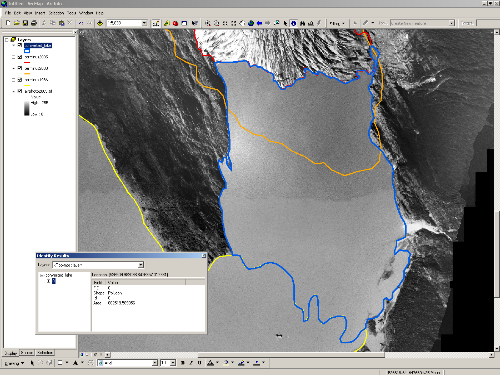 |
Blue polygon showing increase in Mendenhall lake area between 1986 and 2005.
Data processed by Rudi Gens |