A Critical Component of the Alaskan Water Cycle and Climate Change
| Introduction |
Evapotranspiration (ET) measures water loss to atmosphere through soil evaporation and plant transpiration, and is a major component of both the land surface hydrologic cycle and the surface. ET is a process that will become more important as we witness increasing trends in climate warming, permafrost degradation, forest fire occurrences, and significant land use and land cover changes in Alaska.
Significant improvements in our knowledge of magnitude and spatio-temporal variability in ET can be accomplished by using field measurements, remote sensing data, and modeling.
| Hypotheses |
We hypothesize that
- ET is a critical component of the hydrologic cycle in interior Alaska and is a process that will become more important as we witness increasing trends of climate warming, permafrost degradation, forest fire occurrences, and significant land cover changes in interior Alaska.
- Significant improvements in our knowledge of the magnitude of and spatio-temporal variability in interior Alaska ET can be accomplished through our proposed synergistic approach of using field measurements, remote sensing data, and modeling. Currently our knowledge is very limited, and in consequence our estimates are, at best, qualitative.
| ET Project: Spatio-Temporal Scales |
This project has three components: (1) Field measurements (2) ET Modelling (3) Remote Sensing.
In the figure below, the spatio-temporal scales associated with observational data from
ground-based field instruments is shown in green, and with moderate resolution satellite
imagery is shown in yellow. The adapted ET model we propose to use can be applied at any of
the satellite-image scales indicated, and can be integrated up to annual and multi-annual
time scales.
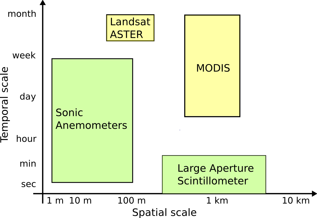 |
| Spatio-temporal scales of ET estimates. Field instruments (green); Satellite images (yellow). Image Credits: Rudiger Gens, This Project. |