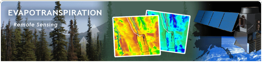
A Critical Component of the Alaskan Water Cycle and Climate Change
| Satellites and Sensors |
To apply the TSEB model over large areas of interior Alaska beyond the limited ET ground data network, that have surface conditions similar to our ET field sites, we will rely on remote sensing data to provide model input parameters. The two remote senisng based input parameters that the model relies on are land surface temperature (LST) and leaf area index (LAI). Land cover classification images provide additional information that can be input in the model.
The figure below lists the characteristics of the main satellite sensors relevant for this study. Though the satellites proposed to be used in this study have a temporal coverage (repeat pass over an area) of about 16 days, due to the high latitude of interior Alaska satellite orbits converge, and in practice we get much higher coverage. For example, on any given day, we can expect four to six MODIS scenes over one interior Alaska location.
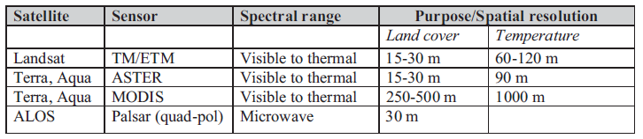 |
| Characteristics of the main satellite sensors relevant for this study.
|