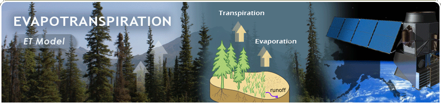
Evapotranspiration:
A Critical Component of the Alaskan Water Cycle and Climate Change
A Critical Component of the Alaskan Water Cycle and Climate Change
Preparatory Science for NASA's planned HyspIRI Mission
| TSEB Model |
- The model we are using based on the Two Source Energy Balance (TSEB) approach described in Norman et al. (1995) and further developed for larger scale applications as the ALEXI (Atmosphere-Land Exchange Inverse) (Anderson et al., 2007) and DisALEXI (Disaggregated ALEXI) (Anderson et al., 2008). For details of this model please refer to the following publications.
- Anderson, M. C., Norman, J. M., Kustas, W. P., Houborg, R., Starks, P. J., & Agam, N. (2008). A thermal-based remote sensing technique for routine mapping of land-surface carbon, water and energy fluxes from field to regional scales. Remote Sensing of Environment, 112(12), 4227-4241.
- Anderson, M. C., Norman, J. M., Mecikalski, J. R., Otkin, J. A., & Kustas, W. P. (2007). A climatological study of evapotranspiration and moisture stress across the continental United States based on thermal remote sensing: 1. Model formulation. Journal of Geophysical Research-Atmospheres, 112(D10), 17.
- Norman, J. M., Kustas, W. P., & Humes, K. S. (1995). Source approach for estimating soil and vegetation energy fluxes in observations of directional radiometric surface-temperature. Agricultural and Forest Meteorology, 77(3-4), 263-293.
| Schematic Diagram |
The schematic diagram representing the TSEB modeling scheme, taken from Anderson et al., 2007 (see full reference above) is given below.
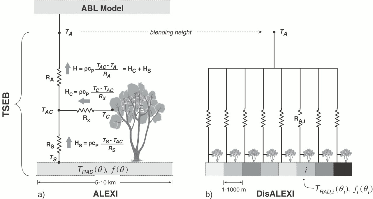 |
| Schematic diagram representing the TSEB modeling scheme used in (a) ALEXI and (b) DisALEXI, highlighting fluxes of sensible seat (H) from the soil and canopy (subscripts s and c) along a temperature (T) gradient, and regulated by transport resistance RA (aerodynamic), RX (bulk leaf boundary layer), and RS (soil surface boundary layer). TSEB uses given vegetation cover (f(θ))and directional surface radiometric temperature (TRAD(θ)) from moderate resolution satellite imagery. ABL is the aerodynamic boundary layer. Source: Anderson et al., 2007. |